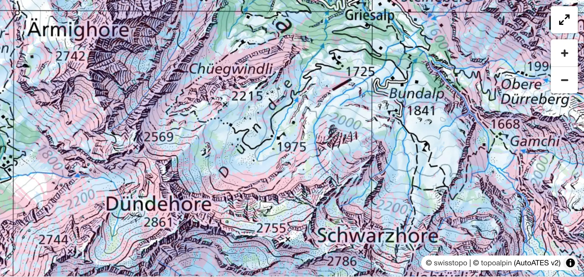
What is ATES?
The Avalanche Terrain Exposure Scale (ATES) classifies terrain by the severity of avalanche exposure — independent of the current danger level. An ATES map answers the question: How exposed is this terrain if an avalanche occurs?
ATES is the international standard for backcountry terrain assessment and is used by avalanche warning services worldwide. The current version ATES v2.0 distinguishes four classes:
| Class | Meaning |
|---|---|
| Simple | Low exposure. Flat or forested terrain with no significant start or runout zones. |
| Challenging | Moderate exposure. Runout zones from start zones above, or moderate steepness. |
| Complex | High exposure. Significant start zones, steep terrain with potential avalanche terrain above. |
| Extreme | Very high exposure. Steep, open start zones, high density of hazard zones. |
Our Model
We compute the ATES classification automatically based on AutoATES v2 with alpine calibration. The calculation involves:
-
Potential Release Area detection (PRA): Slope angle, wind exposure and forest cover are combined via a fuzzy-logic model. Areas with high slab susceptibility are marked as Potential Release Areas.
-
Avalanche simulation (Flow-Py): Starting from the release areas, avalanche runout is simulated using the energy-line model Flow-Py. Forest physically decelerates the avalanche — dense forest more so than sparse.
-
Classification: Slope angle, avalanche reach and the number of overlapping avalanche paths are combined into an ATES class.
All thresholds are calibrated for the Alps — alpine slab avalanches require steeper slopes than in Canada (28° instead of 15°).
Data Sources
The calculation uses high-resolution LIDAR data (5 m raster resolution):
| Region | DEM Source | Forest Data |
|---|---|---|
| Switzerland | swissALTI3D (2 m) | WSL vegetation height model (LiDAR, 1 m) |
| Austria | BEV ALS-DTM (1 m) | BEV DSM/DTM + BFW forest map (LiDAR, 1 m) |
| Italy: South Tyrol | Provincial DSM (WCS, 2.5 m) | DSM − DEM + official forest type map (WFS) |
| Italy: Trentino | Provincial DSM (WCS, 2.5 m) | LiDAR CHM (1 m) → Percent Forest Cover |
| France | IGN RGE ALTI (1 m) | IGN MNH LiDAR HD (1 m) + BD Forêt v2 |
| Slovenia | ARSO DMR (1 m) | CLSS nDMP (50 cm) + MKGP RABA forest mask |
| Bavaria | BVV DGM1 (1 m) | BVV DOM20 (20 cm) + ATKIS forest + scrub |
Forest data in each country comes from the best available official source (LiDAR or image-based) — not satellite-based estimates.
Plausibility Check
The ATES classification was checked against documented avalanche accidents in Switzerland (SLF, ski touring since 1970) and Austria (LAWIS, all accidents in uncontrolled terrain since 2000). This checks whether accident locations fall within modelled avalanche terrain (ATES ≥ 2):
| Region | Accidents | Detected (ATES ≥ 2) |
|---|---|---|
| CH | 2,721 | 87% |
| AT | 2,480 | 82% |
Undetected accidents are predominantly in runout zones or caused by remote triggering. The detection rate increases with elevation: above 2500 m, 90–92% of all accidents are correctly identified as avalanche terrain.
Coverage
The ATES map is available as a map layer in the app:
- Switzerland (complete)
- Austria (complete)
- Italy: Aosta Valley, South Tyrol and Trentino (complete), more provinces (Veneto, Friuli, Lombardy, Piedmont) to follow
- France: French Alps (departments 04, 05, 06, 26, 38, 73, 74)
- Slovenia (complete)
- Bavaria (Bavarian Alps and pre-Alps)
References
- Statham, G. & Campbell, C. (2025). ATES v2.0. Avalanche Canada.
- Toft, H. B. et al. (2024). AutoATES v2.0. Natural Hazards and Earth System Sciences.
- Huber, A. et al. (2023). AutoATES Austria. ISSW Bend.
- D’Amboise, C. J. L. et al. (2022). Flow-Py. Natural Hazards and Earth System Sciences.
- SLF/EnviDat. Avalanche accidents in Switzerland since 1970. CC BY 4.0.
- Autonomous Province of Bolzano — South Tyrol. Digital Surface Model (DSM, 2.5 m) and Forest Type Map. CC0 / Open Data.
- Autonomous Province of Trento. LiDAR CHM (1 m). CC BY 4.0.
- IGN. RGE ALTI (1 m), MNH LiDAR HD (1 m) and BD Forêt v2. Licence Ouverte 2.0.
- CLSS (Ciklično Lasersko Skeniranje Slovenije, 2023–2025). nDMP (50 cm). CC BY 4.0.
- MKGP. RABA land use classification (forest mask). Public data.