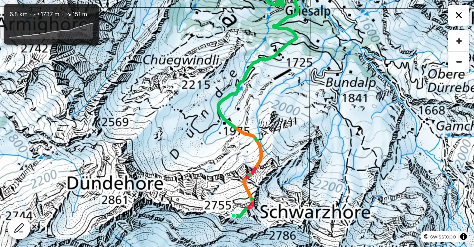
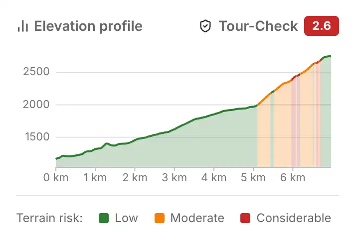
How does the Tour-Check work?
The Tour-Check evaluates each point along your route based on three factors:
- Slope angle — how steep is the surrounding terrain?
- Avalanche danger level — what is the current danger rating for this location?
- Avalanche terrain (ATES) — how exposed is the terrain to avalanches?
This results in a colour for each route segment:
| Colour | Meaning |
|---|---|
| Green | Low risk given the current avalanche conditions |
| Orange | Elevated risk — increased attention required |
| Red | High risk — critically review route choice |
Two Models, Two Questions
The Tour-Check combines two independent assessments:
SLABS — How likely is a triggering?
The SLABS model calculates the triggering probability from the slope angle within a 40 m radius (MSA40) and the current danger level. The steeper the terrain and the higher the danger level, the greater the risk.
ATES — How severe are the consequences?
The ATES classification adds what happens if an avalanche occurs: How far does it run? Are there terrain traps? A steep forest path with no avalanche terrain above stays green. A flat runout below a steep couloir is upgraded at high danger levels — the triggering probability is low, but the consequences are high.
What the Tour-Check also considers
- Elevation and aspect: The danger level is evaluated for the specific location — a north face at 2500 m differs from a south face at 1800 m.
- Forest cover: Dense forest physically decelerates avalanches (modelled via Flow-Py, accounted for in the ATES map).
- Roads and forest tracks: Paved roads never receive Orange or Red.
- Low elevations: Below 1500 m, the risk is dampened.
- Key sections: The three points with the highest risk score are marked to help identify critical passages.
Plausibility Check
The full model (SLABS + ATES) was checked against documented avalanche accidents in Switzerland (SLF, ski touring) and Austria (LAWIS, all accidents in uncontrolled terrain). This checks whether the model detects known accident locations — it does not constitute a full scientific validation (a false-positive analysis is missing). Detection rate depends on the danger level:
| Danger level | CH | AT |
|---|---|---|
| 2 — moderate | 88% | 73% |
| 3 — considerable | 97% | 90% |
| ≥ 4 — high | 100% | 88% |
| Total (DL ≥ 2) | 93% | 84% |
Based on CH 1,553 accidents (2004–2026), AT 1,967 accidents (2000–2026) — only accidents with known danger level ≥ 2.
At danger level 1 (low), the model intentionally shows Green — issuing a warning during favourable conditions would reduce the assessment’s usefulness. 82% of all touring days fall on DL 2–3, where the detection rate is highest.
Limitations
- The Tour-Check is based on the current avalanche bulletin, not local observations
- Ascent and descent are assessed equally
- Temporary hazards (cornices, wet snow, wind-transported snow) are not considered
- The Tour-Check does not replace independent on-site assessment
Coverage
Available for Switzerland, Austria, Bavaria, the French Alps, South Tyrol and Trentino. The Aosta Valley and Slovenia have ATES classification but no machine-readable avalanche bulletin (CAAML format) yet. Further Italian regions (Veneto, Friuli, Lombardy, Piedmont) are in preparation.
References
- Degraeuwe, B. et al. (2024). SLABS — Skiing and Avalanche Base Score. Cold Regions Science and Technology.
- Toft, H. B. et al. (2024). AutoATES v2.0. Natural Hazards and Earth System Sciences.
- Techel, F. et al. (2015). Analysis of avalanche risk factors in backcountry terrain. NHESS.
- SLF/EnviDat. Avalanche accidents in Switzerland since 1970. CC BY 4.0.